ESTABLISHMENT OF IITR-SATELLITE EARTH STATION
A
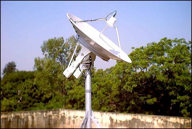
NOAA-HRPT Satellite Earth
Station (sponsored by DST, New Delhi) has been established at Department of
Earth Sciences and has become operational since 24th October 2002.
This IITR – Satellite Earth Station (IITR-SES) has started acquiring AVHRR
(Advanced Very High Resolution Radiometer) data (almost ten scenes per day)
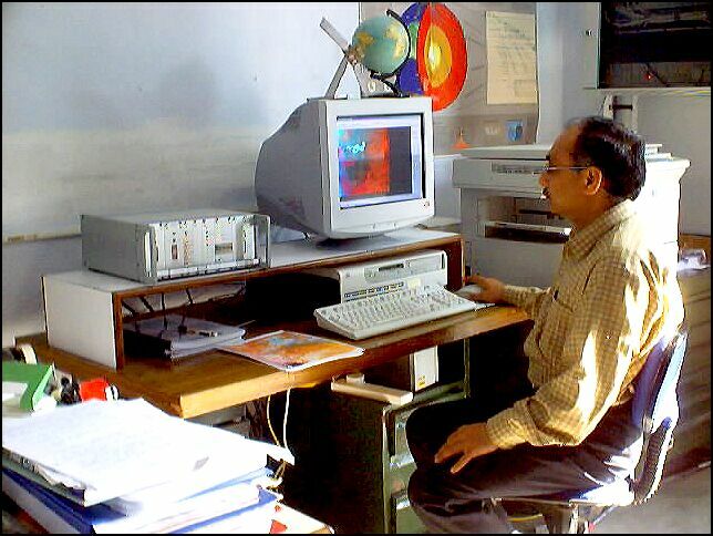
from NOAA-12, 14, 15, 16 and 17 satellites. IITR-SES is a fully computerized and
automatic satellite data acquisition system and works round the clock. The
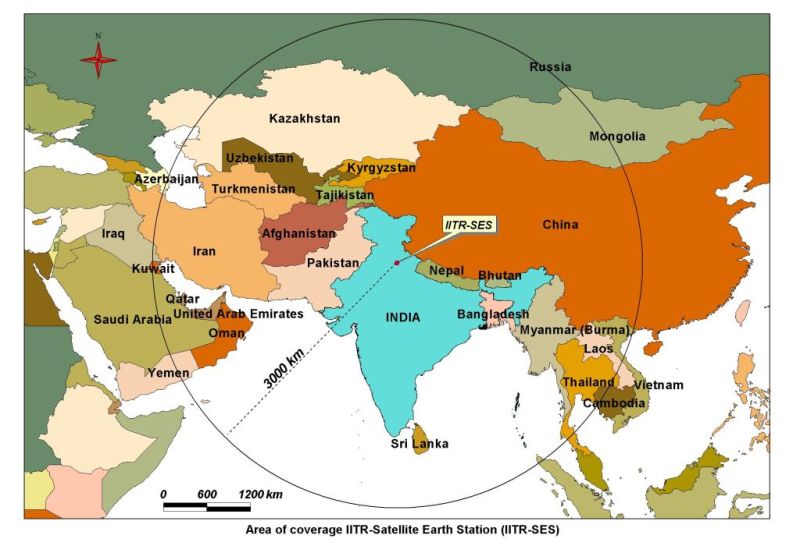
IITR-SES not only acquires data of India, but it also acquires data of many
neighboring and other countries (e.g. Nepal, Bangladesh, Bhutan,
Myanmar, Thailand, Laos, Sri Lanka, Oman, part of Saudi Arabia, UAE, Iran,
Turkmenistan, Uzbekistan, Tajikistan, Kyrgzstan, Kazakhstan, Afghanistan,
Pakistan, parts of Mongolia, China and Russia). The IITR-SES is also
equipped with a fixed GPS receiver and provides its own location, and GPS
satellite based (all GPS satellites are having highly accurate atomic clocks in
them) highly accurate timings (perhaps the most accurate clock in the IITR
campus!) at any instant of time. Under the present DST project, Dr. Saraf is
developing a methodology on NOAA-AVHRR data applications in earthquake studies.
However, NOAA-AVHRR data have wide ranging applications including vegetation
index mapping, drought and forest fire monitoring etc. It is important to note
that this is the first NOAA-HRPT Satellite Earth Station in any educational
institute/university in the country.